1Overview
The Medusa MS-Series are passive gamma-ray survey spectrometers built for real-time aerial radiation mapping and survey. They detect natural gamma radiation (potassium-40, uranium-238, thorium-232, and cesium-137) along with total counts. Operation is simple enough for a first-time surveyor, yet the data is rich enough for an experienced one.
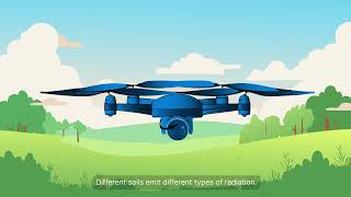
Medusa offers a range of easy-to-use survey tools built to make measuring spatial variation in soil a breeze. At the heart of these tools are gamma-ray spectrometers, which passively pick up the natural radioactivity in the top layer of soil. They are designed with simplicity in mind, so it is easy for individuals of all experience levels to get started with minimal effort.
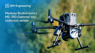
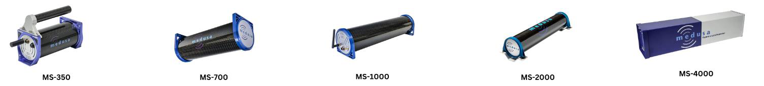
Applications span drone-borne measurements, handheld soil scanning, NORM characterization, and contamination mapping. The series scales from a compact 350 ml crystal up to a 4000 ml configuration, so survey speed and sensitivity can be matched to the platform and the mission.
Features
- Easy to integrate under a drone
- Various scintillator sizes
- Optimized for ease of use
- Integrated data storage and processing
- Life-long feature updates
- Up to 90 km/h mapping speed
Drone or UAV not included. For users prioritizing compact and efficient deployment, the MS-350 sensor is optimized for integration with the DJI M250 RTK drone platform. With flight endurance of up to 30 minutes, this pairing enables comprehensive data collection over extensive areas, ensuring uninterrupted performance for critical survey missions.
2Model Lineup
Five models share the same survey workflow and recording rate. They differ in crystal volume, which sets the trade between mapping speed, sensitivity, and weight. Larger crystals collect more counts per second, so they support higher survey speeds on faster platforms.
| Model | Crystal (CsI) | Mapping speed | Weight | Recording frequency |
|---|---|---|---|---|
| MS-350 | 3×3 in (350 ml) | up to 15 km/h | 2.7 kg / 6.0 lb | up to 5 Hz |
| MS-700 | 3×6 in (700 ml) | up to 20 km/h | 4.7 kg / 10.4 lb | up to 5 Hz |
| MS-1000 | 3×9 in (1000 ml) | up to 30 km/h | 6.7 kg / 14.8 lb | up to 5 Hz |
| MS-2000 | 90×310 mm (2000 ml) | up to 45 km/h | 12 kg / 26.5 lb | up to 5 Hz |
| MS-4000 | 4×4×16 in (4000 ml) | up to 90 km/h | 28 kg / 61.7 lb | up to 5 Hz |
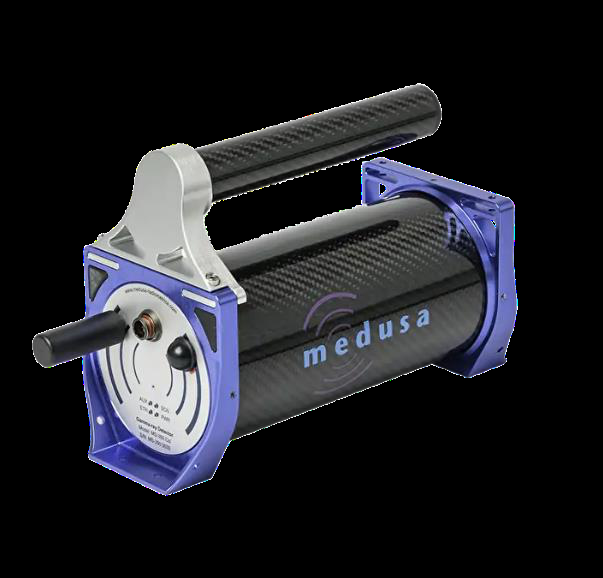
MS-350
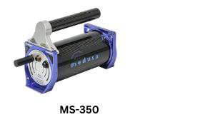
The MS-350 by Medusa Radiometrics is the optimal survey meter for both hand-held and drone-borne operations with a light weight of only 6.0 lbs. The MS-350 utilizes the Medusa Detector Operating System (mDOS) that keeps in-the-field usage simple, whether utilizing it for hand-held contamination mapping, locating a lost source with a UAV, or doing an airborne survey.
The typical mapping speed of the MS-350 is up to 15 km/h, with a recording frequency up to 5 Hz. It contains an ultra-rugged 350 ml CsI scintillation crystal, is optimized for ease of use, has integrated data storage and processing, and includes life-long feature updates.
MS-700
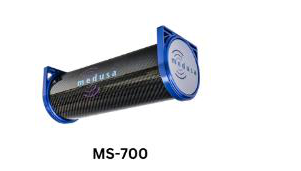
The MS-700 is optimized specifically for drone usage and is ideal for a wide range of applications such as prospecting, soil mapping, and pollution mapping. Its payload is under 5 kg, which means that the MS-700 is well-suited for off-the-shelf drones.
MS-1000
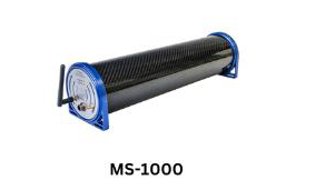
An all-in-one sensor system, the MS-1000 is robust, standalone, and can pair with a drone but is not limited to drone use applications. It features a spectrometer, GNSS, pressure, temperature, and humidity sensors. Real-time analysis and onboard storage are made possible with mDOS.
MS-2000
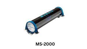
A scanner that is specialized for vehicle-borne mapping, the MS-2000 is an autonomous, low-power, and robust gamma-ray sensor. It is complete with a vibration-dampening mounting system and ultra-rugged housing made of Kevlar-reinforced carbon fiber. Users can mount the MS-2000 on a variety of vehicles such as quad bikes, tractors, cars, and even larger drones.
MS-4000
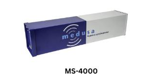
The MS-4000 is a lightweight airborne gamma-radiation detection system (AGRS) that can be placed within small airplanes or helicopters. It covers a multitude of applications and has been widely used for mineral exploration and remediation surveys by customers involved with geophysical survey companies, geotechnical consultants, and research institutes.
3Specifications
Gamma-Ray Spectrometer
| Parameter | MS-350 | MS-700 | MS-1000 | MS-2000 | MS-4000 |
|---|---|---|---|---|---|
| Scintillation crystal | 3x3'' (350 ml) CsI | 3x6'' (700 ml) CsI | 3x9'' (1000 ml) CsI | 90x310mm (2000 ml) CsI | 4x4x16'' (4000 ml) CsI |
| Typical mapping speed | Up to 15 km/h | Up to 20 km/h | Up to 30 km/h | Up to 45 km/h | Up to 90 km/h |
| Recording frequency | Up to 5 hz | ||||
| Radionuclide analysis | 40K, 238U, 232Th and 137Cs | ||||
Electrical
| Parameter | MS-350 | MS-700 | MS-1000 | MS-2000 | MS-4000 |
|---|---|---|---|---|---|
| Input voltage | 5 – 35 V | 12 - 35 V | |||
| Power consumption | 3 W (average), 6 W (max) | ||||
| Battery | Up to 8 hours | Car Battery | |||
GPS
| Parameter | MS-350 | MS-700 | MS-1000 | MS-2000 | MS-4000 |
|---|---|---|---|---|---|
| Type | uBlox ZED-F9P | ||||
| Accuracy | 1.5 m CEP | ||||
| RTK accuracy | <1 cm | ||||
| Signals | GLONASS, BeiDou, Galileo | ||||
Mechanical
| Parameter | MS-350 | MS-700 | MS-1000 | MS-2000 | MS-4000 |
|---|---|---|---|---|---|
| Dimension | 100 (Ø) x 215 (L) mm | 100 (Ø) x 295 (L) mm | 100 (Ø) x 375 (L) mm | 120 (Ø) x 605 (L) mm | 17(h) x 20(w) 86(l) cm |
| Weight | 2.7 kg / 6.0 lb | 4.7 kg / 10.4 lb | 6.7 kg / 14.8 lb | 12 kg / 26.5 lb | 28 kg / 61.7 lb |
| Operating Temperature | -20 to +65 °C | ||||
| IP rating | IP65 | ||||
Connectivity
| Parameter | MS-350 | MS-700 | MS-1000 | MS-2000 | MS-4000 |
|---|---|---|---|---|---|
| Wi-Fi | 2.4 and 5 GHz | ||||
| Ethernet | 100 Mbps | ||||
| Port | RS-232 | ||||
Data
| Parameter | MS-350 | MS-700 | MS-1000 | MS-2000 | MS-4000 |
|---|---|---|---|---|---|
| Format | JSON, NMEA, CSV | ||||
| Streaming | RS-232, ethernet and Wi-Fi | ||||
| Sensors | Spectrometer, GPS, PTH | ||||
| Internal storage | 16 GB, 500 hours of data | ||||
4Included Software
| Onboard-processing (by mDOS) | Post-processing (by GammAn) |
|---|---|
| Real-time analysis | Full spectrum analysis (FSA) |
| Survey planner | Window analysis (WA) |
| Real-time radionuclide inspection | |
| Sample measurements |
5Applications
- Drone-borne measurements
- Handheld soil scanning
- NORM characterization
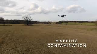
- Contamination mapping
- Soil science and precision agriculture
- Geochemical and mineral mapping (prospecting)
- Mineral exploration and remediation surveys
6Support
| Parameter | Specification |
|---|---|
| Online support | Extensive library of support guides |
| Custom support | Optional |